Frazier Falls Trail
Thought for today: Philippians 4:8 ..Whatever is true, whatever is noble, whatever is pure, whatever is lovely, whatever is admirable - if anything is excellent or praiseworthy, think about such things..
Disclaimer: There is no assurance that any resource or activity I've found or described will be as 'accessible' as you might need. Information or links may be out of date. Use the information at your own risk and be sure to check with your health care professional for exercise advice.
Frazier Falls Trail in the Lakes Basin Area of Plumas National Forest is a definite bucket list adventure for anyone with mobility challenges! The trail is quite popular, with people of all ages and capabilities enjoying the walk.
DIRECTIONS: From Graeagle, head south on Highway 89 towards Truckee for about a mile and a half until you reach the turnoff for Gold Lake Highway. Take a right on Gold Lake Highway and continue up the scenic road for roughly another one and a half miles. The turnoff for the road towards that falls is on the left and is marked with a small sign indicating Frazier Falls Trail.
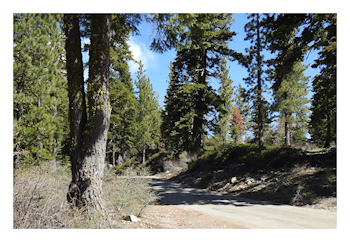 The road to the falls is four miles long, very narrow and marginally paved. Drive cautiously and watch for drivers coming in the other direction. You'll pass a trail head for Frazier Creek which is a dirt trail. This is NOT the correct trail. Keep going on the road. Once you reach the trail head for the falls, you will see the paved parking area, restrooms, and picnic area.
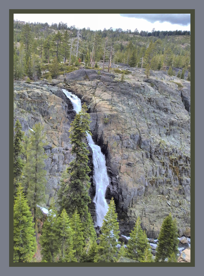
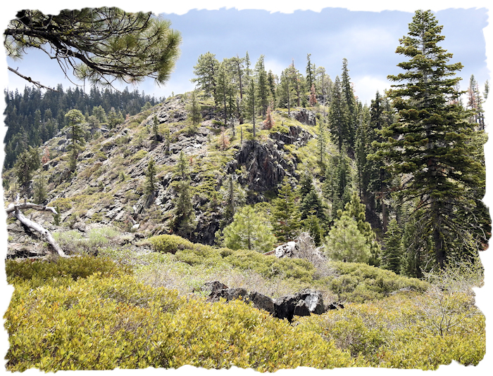
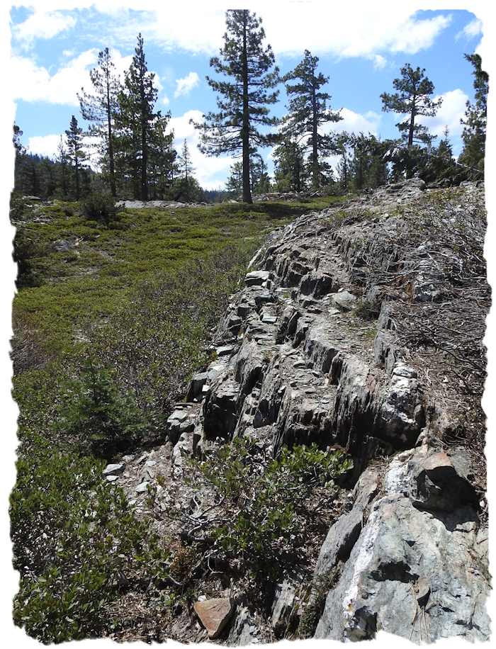
At 6,000 foot in elevation, the trail winds through glacial terrain, with dramatic rock outcroppings, wildflowers, and impressive views of the surrounding skyline. The falls cascades at least 176' down a rock face and is absolutely spectacular in spring.
In 2008 the Graeagle Lions Club adopted this national forest trail and they've done an outstanding job! Volunteers widened, straightened, graded and paved the half-mile trail and installed regularly spaced benches. Here's a pretty good description of the overall trail experience.
While it is generally described as an 'easy' trail at various trail review sites, this description is misleading if you use a rolling walker or wheelchair. It's a moderately difficult trail you use a mobility device. The paved trail is about 4 foot wide going the first one quarter mile to a lovely wooden bridge that crosses Frazier Creek, then an additional quarter mile to the Falls Overlook. It's one mile round trip.
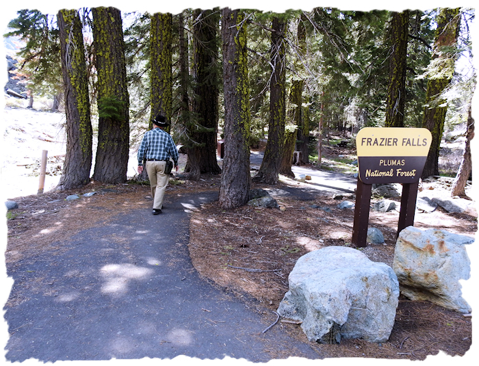
This estimation of distance is helpful in that the bridge across the creek is a destination in itself in terms of photography and scenery. Once you reach the bridge you can gauge your energy levels and decide whether to travel the next quarter mile to the falls overlook or to turn back. Do what is best for you.
There is an 'accessible' restroom off the parking lot, which has a couple of designated handicap parking spaces. Picnic tables line both sides of the first few hundred feet of the trail. 2 picnic tables have some paving to the ends of the tables, for wheelchair access. Note: If you plan to walk the trail, be sure to use the restroom before heading out as the walk may take longer than expected, maybe much longer than planned.
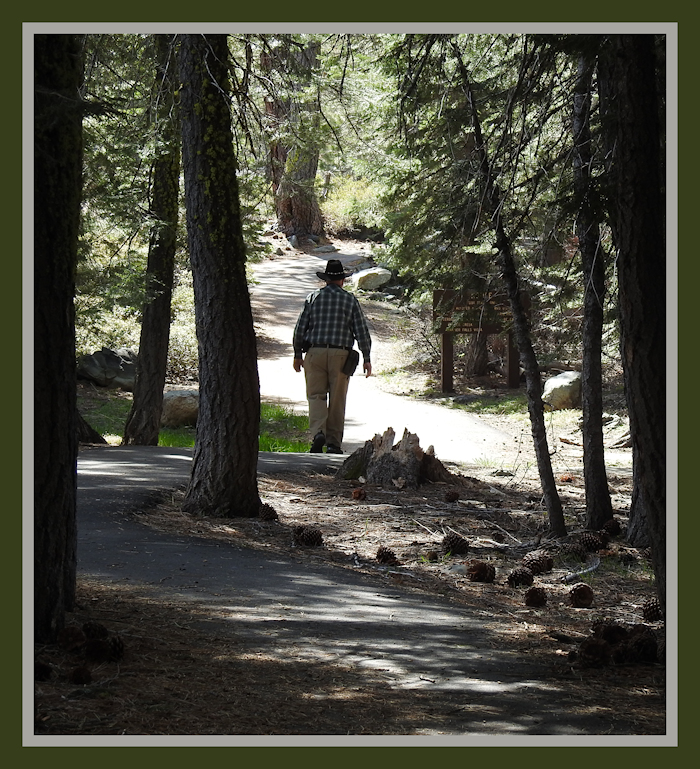
At the end of the picnic table area, there is a nice large sign next to the trail saying 'foot travel only' (with the exception being wheelchairs and rolling walkers) giving the distances to the creek and falls.
The trail is closed to bicycles. However, some bicyclists chose to ignore the rules when I was there and refused to walk their bikes when asked, so stay alert as the trail is not really wide enough for both a bike and a wheelchair or rolling walker to pass each other safely without one having to get off the pavement. I've requested the USFS install a bike rack and large sign at the very entrance of the trail. Something like a big white sign with the image of a bike with a big 'X' across the bike image that is impossible to 'not see'. It's a safety issue.
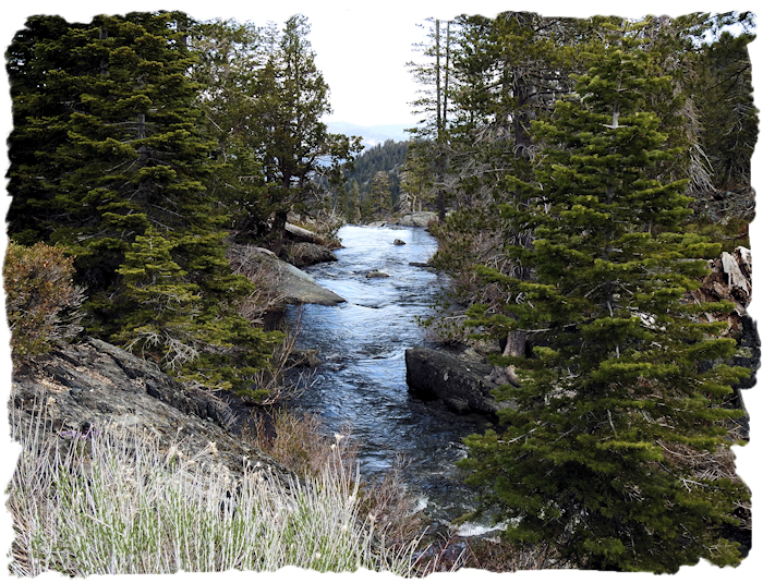
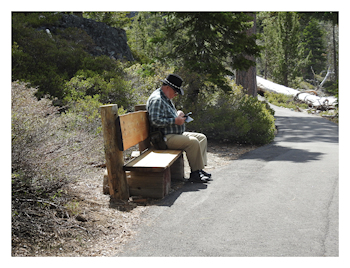 Every bench along the trail provides a great view. Take some time to enjoy the bridge view of Frazier Creek. Upstream you'll see some lovely aspen and pretty creek vegetation. This is a great photo point. If this is your first time here you may not quite realize that the creek vanishes by dropping dramatically down the face of the mountain. (Note: Do not let kids or pets get into the stream anywhere along here as they could easily go over the falls and wouldn't survive.)
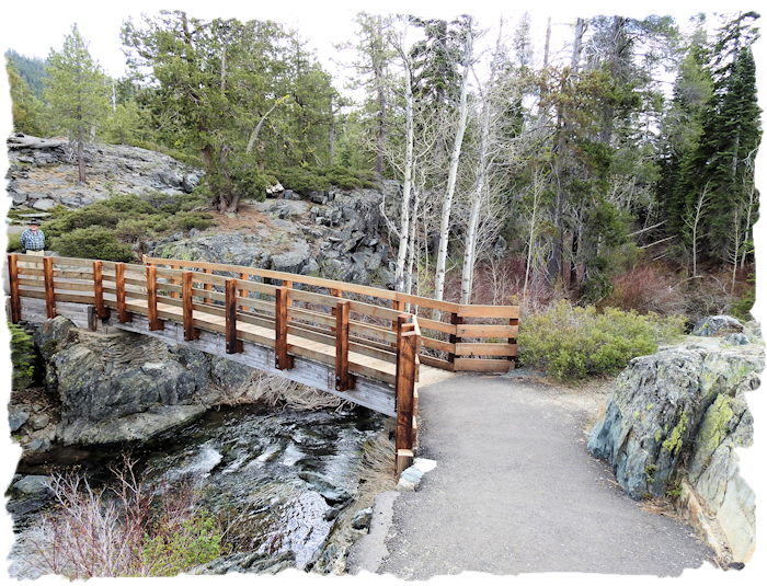
Every mobility challenged person needs to take into account that it will take as much energy to go beyond the bridge to the falls as it took to get to the bridge. You have consider the return trip energy requirements at this decision point. At 6000 feet in elevation, you may have less energy than you expect.
If you choose to go on to the Falls overlook, you will find spectacular views of Frazier Creek Falls. You essentially are looking back at the creek you previously crossed as it cascades down the face of the mountain. In spring the water flow makes for a great waterfall. Later in the year I am told the flow dwindles.
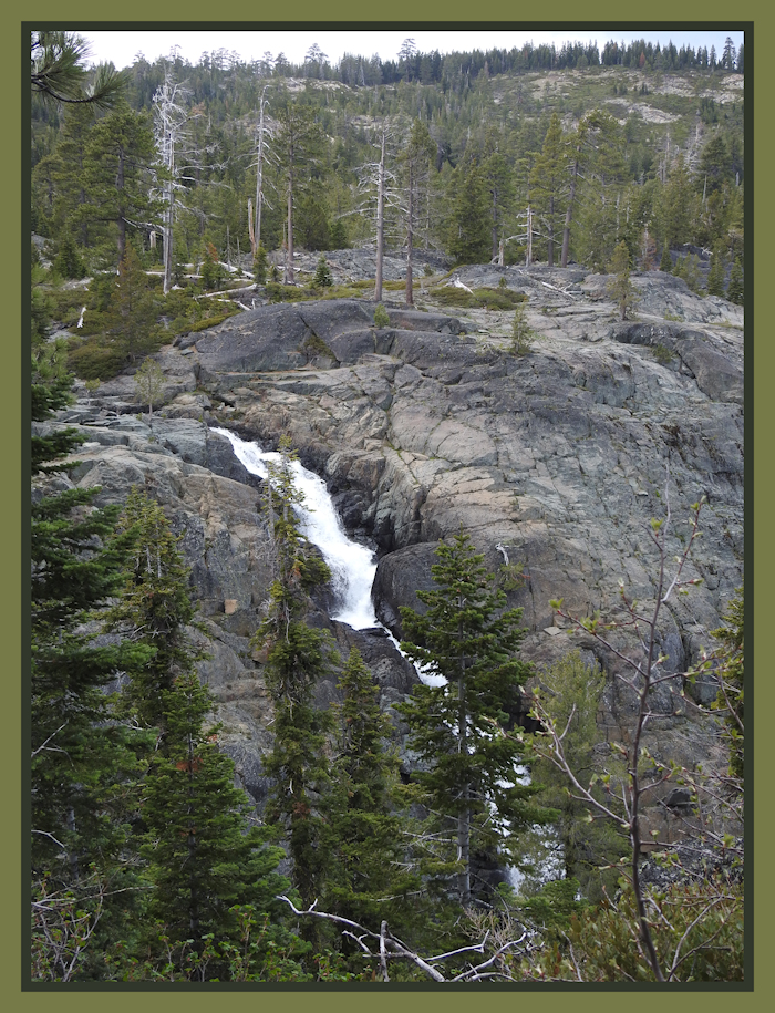
The Falls Overlook has some very good photo points. I did not go down into the extreme end of the overlook as it was not 'accessible', but the two main locations to view the falls are quite excellent. For just a few moments the sun came out while we were in sunlit mountain majesty.
The walk back is still great! Everything looks different (and equally photogenic) going the other direction. The rock formations, the mountain skylines, and sometimes spectacular cloud formations make the return trip an equally wonderful walk. Plus, the walk doesn't seem as long going back the way you came (or maybe it's all the well placed benches).
TIME: Unimpaired walkers will probably leisurely walk the whole trail, spend some time looking at the falls, and be back at the parking lot in under an hour. To get a better idea of how long it takes someone walking with the aid of a mobility device like a rollator, it took me 3 hours to complete the full 1 mile round trip pushing 'Big Red'. I walked a few hundred feet then rested on a bench or took photos, then walked to the next bench. It took a lot more time than I anticipated, but it was worth it!
If you are walking with a mobility device, or using a manual wheelchair, you should allow at least 3 hours for the round trip. If you know how fast and how far you can usually walk, then double your usual time for that distance to allow the higher elevation. If you are using an electric wheelchair, it should take substantially less time. I suggest a morning walk. Do take water, some food bars, carry a jacket, and wear a sun hat. Maybe plan to picnic after the return walk.
As you might have guessed, the trail is not 'level'. There are ups and downs, twists and turns. These features actually enhance the loveliness of the trail experience but they can also make mobility walker tired. Fortunately, the resting benches are well placed along the trail.
I think I took advantage of each and every bench along the trail. Some of the benches are lower than I'd like, but the bench backs are sturdy and can be used to help a person lever to standing position. I was definitely pooped at the end of the hike, but exhilarated, when I got back to the parking lot.
Overall, I found the trail to be moderately difficult pushing 'Big Red'. There are some difficult short grades with 10 percent (or higher) inclination. I was able to handle the inclines, but it meant a lot of braking on the downslope and some serious pushing on the upslope. There is also a percentage of pine and fir needles on the path that might affect wheel traction in some spots.
While I was the only person using a mobility device while we were there, families were using jogging strollers for their littlest members, and there were lots of grandparents walking, too. I'm not sure all the grandparents were as enthusiastic as the kids, but hey, they all looked like they were enjoying the day. If you want less people, go on a weekday.
For me Frazier Falls was a 'bucket list' trail and definitely worth the effort. It is the prettiest barrier-free trails I've visited so far in terms of overall experiences. Even though it was moderately difficult for me and took significantly longer to walk than I anticipated, it was a simply wonderful visual experience. Do go - you'll be very glad you made the effort!
Accommodations: Finding accessible accommodations on what turned out to be Mother's Day weekend was not an easy task. Graeagle is an area well known for its numerous golf courses but it is a very small community. About 10 miles away is Portola, a somewhat larger community. Quincy is about 26 miles away.
I was able to make a reservation at the Lodge at Nakoma, which turned out to be an excellent choice. It is somewhat more expensive than other possible locations due to the daily addition of a 'resort fee' of $25. Cost per day for a King room was about $205 total in May 2018 (including the $25 daily resort fee). It's a lovely hotel and you can use the brand new gym and spa facility, too. The hotel is on a county road between Graeagle and Portola.
If you need a fully handicap accessible room with a roll-in shower, then call instead of booking online. Make sure the room will meet your needs. They have an elevator, too. Our room was a standard king, but my rolling walker had plenty of room to maneuver. The view of the woods was lovely.
Additionally, the WigWam restaurant that is a part of the Nakoma Resort (and golf course) has spectacular food. The chef came out to discuss my gluten-free/casein-free requirements, we had a lovely meal at what I considered a reasonable price for a fine restaurant.
There are several additional hotels near Portola, (like Chalet View Lodge) so you have options. In terms of RV and camping, there are a number of private and public campgrounds near and around Gold Lake, aka Lakes Basin Recreation Area. (Plumas National Forest, Tahoe National Forest)
On the return trip we ate lunch at the Graeagle Meadows Golf Course Restaurant in Graeagle. They were able to prepare a gluten-free lunch, so I was happy. The view over the golf course was terrific. There are additional eateries in Blairsden, too.
I guess the point I am trying to make it that you have to do considerable research when exploring Plumas County. As a rural county you will find some absolutely wonderful surprises but you may miss a fabulous opportunity if you don't plan ahead.
Other Considerations: The Lakes Basin Recreation Area has an abundance of outdoor activities. Mountain biking is hugely popular in the region. Hiking, Camping, fishing, Boating, OHV, Horseback riding, it's all here.
Have a great time in Plumas County! Even if you don't hike and come for the scenic drives or fall color, you won't be disappointed!
There are lots (and lots, and lots) of places yet to be reviewed and I am unlikely to get to them all. So that others may find some new places, I've compiled a draft list of locations that may be wheelchair accessible. These are POSSIBILITIES, no certainties. Some places may be complete duds. ATTENTION: this is a ROUGH draft list - mostly for my own use, so if you use this draft list, lower your expectations and do your homework! DRAFT PLUMAS COUNTY ACCESSIBLE RECREATION LIST