Muletown Road Trip
Thought for today: Philippians 4:8 ..Whatever is true, whatever is noble, whatever is pure, whatever is lovely, whatever is admirable - if anything is excellent or praiseworthy, think about such things..
Disclaimer: There is no assurance that any resource or activity I've found or described will be as 'accessible' as you might need. Information or links may be out of date. Use the information at your own risk and be sure to check with your health care professional for exercise advice.
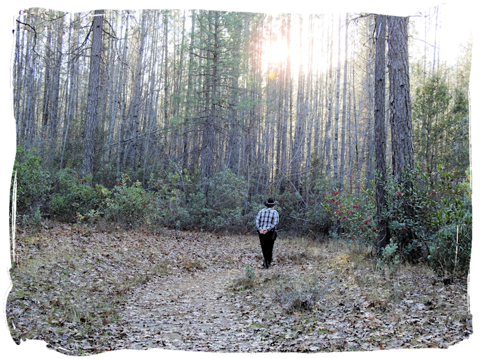
One of the trails I had hoped to walk during 2017 was the Guardian Rock Vista Point Trail at Whiskeytown National Recreation Area (WNRA).
In 2017, December in northern California was devoid of rain and among the driest on record since the 1880's. Consequently the Muletown Road between the Igo area (western Shasta County) and Whiskeytown National Recreation Area was open. The Muletown road surface was much better in December than in spring months. Plus, the creek crossings along the road were low in water.
Bill did some forestry field work on one Friday morning and we hit the road - stopping by Vittles Restaurant in Anderson for lunch. Our idea was to arrive at the trail head during the afternoon 'golden hour' for optimal photography.
The quickest way to the Guardian Rock Trail is through the Whiskeytown National Recreation Area from Highway 299W. A day use permit is needed (if you don't already have a federal parks pass.) If you are only going to be in the vicinity for just one day, you may want to spend the whole day around Whiskeytown Lake and take advantage of the Guardian Rock Trail as well as the Crystal Falls Trail and the other wheelchair 'accessible' amenities in the WNRA.
We chose to do the WNRA trails on different occasions. It's one advantage of Access Passes or various annual passes - you don't have to do everything in one day. Since we had recently driven from Highway 273 (between Redding and Anderson) to Clear Creek Gorge Overlook (part of the Clear Creek Greenway), we wanted to further explore the back roads between 273 and Whiskeytown National Recreation Area.
For this day trip I downloaded 2 useful maps:
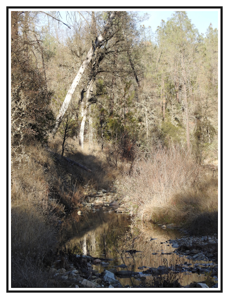 For exploring the Muletown Rd area, from Highway 273 (between Redding and Anderson) you take Clear Creek Rd west (passing by various BLM trailheads in the Swazey Recreation Area), turn right on Cloverdale RD, and Right on Placer Rd, cross over Clear Creek bridge and start watching for the sharp left turn onto Muletown Rd.
Do stop at the Clear Creek Gorge as it's quite photogenic. I was surprised at the depth and prettiness of the gorge. It looks like about 70' to the creek with lovely rock walls and Creekside foliage. If you get lucky you'll see salmon in the creek. There may be some maps in a box, there, and there's an ADA restroom.
Further up Clear Creek you'll pass through some of the Clover Fire damaged areas. The Clover Fire occurred in September 2013 and it consumed several thousand acres in a matter of hours due to high winds. It's a reminder that wildfire is an annual danger throughout Shasta County. Make sure you are always prepared for the possibility of wildland fire when exploring.
Note: I would recommend staying off backroads during the depths of summer or any time fire conditions are severe. Muletown Rd is particularly difficult to exit swiftly, at either end.
The first 3 miles of Muletown Road is paved. Beyond that, a 4-wheel drive or SUV is definitely recommended. Much of the 8-10 mile distance is essentially rough, slow, extremely rocky one lane dirt and gravel road surfaces with 2 water crossings and numerous pullouts for trail heads. In Spring the crossings might have a considerable flow of water. In this dry December, the creeks were a few inches deep. It's a backcountry road.
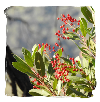 During the winter months you may find an abundance of bright red coffee berries on bushes along the road. At least I think they were coffee berries. Note these are not the kind of berries that you make coffee with - it's just a California shrubby bush that has pretty red berries in winter. Do not eat the berries. When you cross into the WNRA, the road surface improves somewhat to gravel.
Nearing the Paige Bar Rd turn there will be a sign with an arrow pointing left and the word DAM, which is all the indication you get for Paige Bar Rd (a gravel road). Turn left onto Paige Bar Road. Then watch for the area known as Horse Camp. At Horse Camp, the road widens out into a large dirt and gravel parking area with a restroom, parking, picnic tables, and the Guardian Rock trail head.
While we saw a couple of parked vehicles along the way (the whole area is rife with mountain bike, hiking and equestrian trails) we didn't actually see any other people that whole trip. It was a lovely outing!
The Guardian Rock Overlook Trail description is not particularly accurate for slow wheelers like me. The trail is about 1/4 mile long, but it isn't actually flat (despite that description on a WNRA web site). If you are using a manual wheelchair, the trail is roughly 4 feet wide, and composed of packed decomposed granite. The surface is good.
It starts off level, then goes uphill at about a 3 percent grade for a few hundred feet, then slopes down for the rest of the distance to the Overlook at a guesstimated 3 percent to 5 percent grade. So, going down to the Overlook is easy. Going back up will take some extra time and muscle. It's very do-able, just not exactly flat.
The trail surface is well packed, but it is not paved. For manual wheelchairs or all-terrain rollators, it should be fine. Small wheeled devices may be less suitable.
If you like to take photos, the Guardian Rock Trail itself is particularly scenic with a variety foliage and thick tree stands. Even in its winter bareness it was lovely. Picking the best hour for photography is tricky. Upon this occasion, we arrived at the trailhead in late afternoon, which was almost too late in the day for good light.
I had some nice photo opportunities along the trail of catching the afternoon sun through the backlit stands of trees. I also tried a couple of artful slow shutter tactics to see how the tree stands would look. I should have taken more photos of the leaves scattered on the trail. I have to remember to slow down and take more time when we 'arrive' at a destination. It's better to take a lot more photos when you are already 'there'!
By the time we hiked down to the Overlook, the large creek at the canyon bottom was in shadow. I'm happy with the photos I took, but in mountainous areas the photographic rule of the Golden Hours being best for photography, are not exactly the same as when in the flats. Canyons have different lighting times.
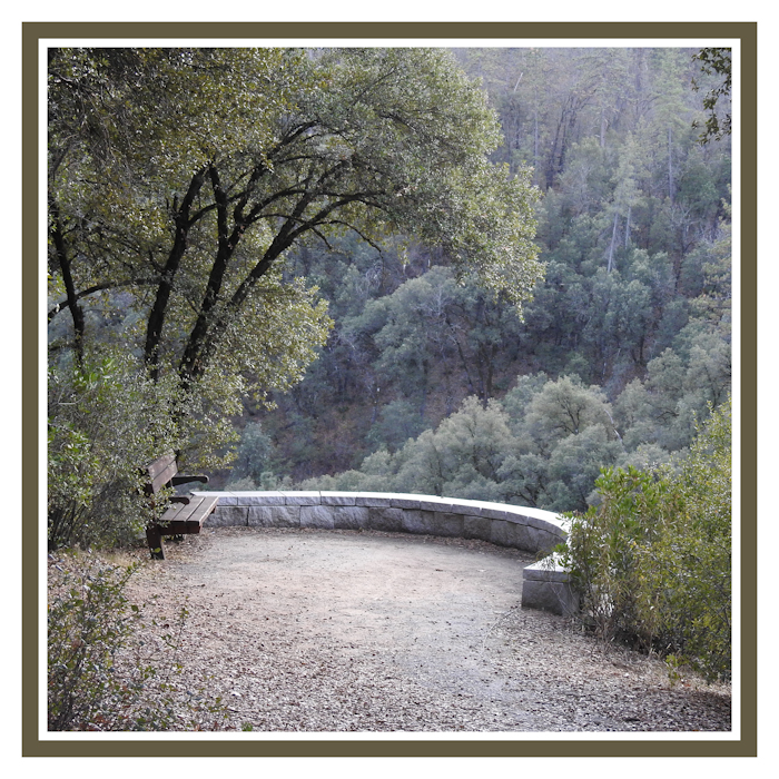
It's a good trail to experiment with different camera settings due to the variety of trail scenery. The Overlook itself provides very nice views of Clear Creek Canyon and nearby peaks. Plan on spending some time at the Overlook. There is a nice bench for resting while waiting for light changes.
We noted that there seems to be a trail off the pathway that leads along the canyon rim back towards Kennedy Memorial Drive. While it looked wide at the point of entry, we did not explore it. It's a long drop down to the bottom. Another time my husband will scout the trail to determine if it is passable for me and my walker. I think it goes to the actual Guardian Rock according to various hiking blogs.
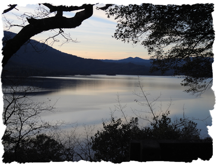
Pushing 'Big Red' back up the hill to our vehicle, we loaded back up and went on down Paige Bar Rd to Kennedy Memorial Drive. We went right, towards Highway 299W. It was approaching sundown and Whiskeytown Lake was quite beautiful in that lighting. There are several pullouts along the lake for scenic views and to access trails down to the shore. My favorite spot for photos is a pullout near the Headquarters. There is a nice bench there and a very good observation point with a reasonably unobstructed view of the lake.
Once we were done for the day we headed back down 299W into Redding, and went out 299E towards Bella Vista and ate dinner at Dry Creek Station, a popular local spot for steak. It was our version of celebrating the end of 2017 - a nice little photo journey plus eating lunch and dinner out. And, I'd like to do it again, soon! There really is a lot to explore and enjoy around Shasta County!
*There are lots (and lots, and lots) of places yet to be reviewed for wheelchair accessibility and I am unlikely to get to them all. So that others may find some new places, I've compiled a draft list of locations that may be wheelchair accessible. These are POSSIBILITIES, no certainties. Some places may be complete duds. ATTENTION: this is a ROUGH draft list - mostly for my own use, so if you use this draft list, lower your expectations and do your homework! DRAFT SHASTA COUNTY ACCESSIBLE RECREATION LIST